


Revisiting the Places and Spaces Mapping Science exhibit during Geography Awareness Week
KENNESAW, Ga. (Nov 18, 2020) — During virtual Geography Awareness Week in 2020, we take a look back at the Places and Spaces: Mapping Science exhibit hosted at Kennesaw State University one year ago. The Places and Spaces: Mapping Science exhibit was on display from November 4 through mid-December 2019 at the Social Sciences building atrium on the Kennesaw campus. The arrival of the exhibit at Kennesaw State, sponsored by a 2019-2020 College of Humanities and Social Sciences Student Success Teaching Incentive Grant, coincided with Geography Awareness Week 2019 celebrated by the National Geographic Society, the American Association of Geographers, and other organizations, every year in the third week of November.
The visually stimulating maps in the exhibit take the viewers through the evolution of science mapping from its early beginning to the current modern day cutting edge technology. The innovative collection has been curated over a ten year period and explores the relationship between science, geography and data visualization.
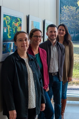
Dr. Paul McDaniel, associate professor of geography, recipient of the 2020 Early Career Award for Scholarship, Teaching and Service from the Ethnic Geography Specialty Group of the American Association of Geographers, and a member of a team from the Department of Geography and Anthropology that brought the mapping exhibit to KSU said, “The exhibit bridges the natural sciences, social sciences, and humanities, through geography and geographic information science, or GIS. This is an opportunity to educate and bring awareness to the community on the important contributions in many areas of society made by geographers locally and globally.”
The maps are an excellent example of how patterns in big data points are visualized and applied to make more informed decisions and to tell valuable stories that people can better appreciate. The topics range from “Tectonic Movements and Earthquake Hazard Predictions,” to “Impact of Air Travel on Global Spread of Infectious Diseases,” to “Literary Empires: Mapping Temporal and Spatial Settings of Victorian Poetry.”
According to Artis Trice, 2019 Newman civic award winner, 2020 Taco Bell Foundation Live Mas Scholarship recipient, and a senior geography major with a minor in environmental studies, “The exhibition is so unique because it draws inputs from interrelated disciplines. Having an exhibit that shows how mapping can depict trends from food production to disease spread can engage students and faculty with different interests.”
“I was fortunate enough to find a major that is interdisciplinary and has areas like my interests in cultural ecology and sustainable development to focus on,” Trice said.
As pointed out by Dr. Vanessa Slinger-Friedman, professor of geography and recipient of the 2016 University System of Georgia’s Regents’ Award for the Scholarship of Teaching and Learning, the exhibit showcases the relevance of geography to students, “It shows that geography can be used to dynamically blend science, social science, humanities, and technology to tackle real world problems.
For instance, geography, GIS and big data analysis through mapping are crucial when leading retailers to make strategic business decisions about new site locations, market areas and demographics based on specialized research done by geographers. Furthermore, as we have all learned in 2020, geography and geographic information science provide a vital skills set and tools for understanding and managing global and local impacts of the COVID-19 pandemic.
Mapping geographic information systems with urban and rural geography plays a key role in determining the environmental health issues that impact our economy. Dr. Jun Tu, professor of geography, advocates the importance of hosting the Places and Spaces: Mapping Science exhibit at KSU as it brings to the forefront an emphasis on the integration of areas like GIS, spatial statistics and the influence of urbanization on the natural environment.
Kat Tucker, a senior GIS Analyst at Byers Engineering Company and recent graduate of the GIS degree program (now the BS in Geospatial Sciences degree program) at KSU said, “I support the Places and Spaces exhibit and come back to KSU to help inspire prospective students about GIS. The relationships I gained in class played an important role in finding jobs in geography.”
Additional photos from the exhibit opening reception last year during Geography Awareness Week 2019 are available on the Department of Geography and Anthropology Facebook page and on the Places and Spaces: Mapping Science virtual page. To learn more about opportunities with geography, geospatial sciences, environmental studies, and GIS, visit the Department of Geography and Anthropology.
-Story by Karen D'Souza


